




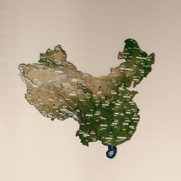


Asia & Middle East Country Maps
69 products
Wooden maps of more than 50 countries across Asia and the Middle East, in natural layered wood, UV printed flag colors or framed cork.


Our Asia and Middle East maps are 3D wooden maps of single countries, from Lebanon and Iran to India, China, Japan and Indonesia. The collection holds 62 maps in three styles, in sizes from about 30 cm up to 195 cm.
Which style of Asian country map should I pick?
| Style | Look | Sizes | Examples |
|---|---|---|---|
| Natural layered wood | Regions raised in multicolor wood layers | Three sizes, mostly 40 to 90 cm | India, Iran, Saudi Arabia, Lebanon, Japan up to 135 cm |
| UV printed wood | Flag colors, a satellite image or the Nimbus, Sage and Soil palettes | Four sizes, 50 to 195 cm | China, India, Indonesia, Thailand, Kazakhstan |
| Framed cork | A pinnable cork map in a black or white frame | 43 x 58 and 58 x 80 cm | Lebanon and Iran |
Which Asian countries can I find here?
In the Middle East there are Lebanon, Palestine, Syria, Jordan, Iraq, Iran, Saudi Arabia, the UAE, Qatar, Kuwait, Oman and Yemen. South Asia is covered by India, Pakistan, Bangladesh, Nepal, Bhutan, Sri Lanka and Afghanistan. From East and Southeast Asia come China, Japan, both Koreas, Taiwan, Mongolia, Vietnam, Thailand, Cambodia, Laos, Myanmar, Malaysia, Singapore, Indonesia, the Philippines, Brunei and East Timor, and Central Asia and the Caucasus add Kazakhstan, Uzbekistan, Turkmenistan, Tajikistan, Georgia, Armenia, Azerbaijan and Russia.
Frequently asked questions
Is there a map of North and South Korea together?
Yes. The North Korea and South Korea map shows the whole peninsula in layered wood, from 44 x 80 cm up to 100 x 180 cm.
Why are some maps much taller than they are wide?
Each map keeps the real outline of its country. Palestine, Vietnam and Myanmar are long and narrow, so the Palestine map is 15 cm wide and 40 cm high in its smallest size.
Maps of other regions are in country maps.